 Comoros, Africa Comoros, Africa
Union des Comores
Udzima wa Komori
Union of the Comoros
Quick Facts About the Country
Capital - Moroni
Government - independent republic
Currency - Comoran franc (KMF)
Area - 2,170 sq km
Population - 690,948 (July 2006 est.)
Language - Arabic (official), French (official), Shikomoro (a blend of Swahili and Arabic)
Religion - Sunni Muslim 98%, Roman Catholic 2%
Calling Code +269
Internet TLD .km
Time Zone UTC +3 Country Background
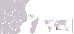
The Comoros, officially the Union of the Comoros (French Union des Comores, until 2002 the Islamic Federal Republic of the Comoros), is a country in the Indian Ocean, situated at the northern end of the Mozambique Channel between northern Madagascar and northern Mozambique. The country consists of three of the four main islands in the volcanic Comoros archipelago: Grande Comore, Mohéli and Anjouan. The fourth island in the island group, Mayotte, is not part of the country. Mayotte has voted against independence from France, but is claimed by Comoros. The country's territory also encompasses many smaller islands. Its name was adopted from the word al-qamar, meaning 'of the moon', as seen depicted on its flag.
(Wikimedia Foundation, Inc)
Weather and Climate
The islands, which lie within the region of the Indian Ocean monsoons, experience a dry season between April and October, and they receive heavy tropical rains accompanied by cyclones between November and March. Daily temperatures seldom rise above 30°C (85°F), and 5,080 mm (200 in) of rain per year fall on the slopes of Karthala, the site of the heaviest rainfall in Comoros. In spite of the heavy rainfall, the porous nature of the volcanic rock means that no water is retained on Njazidja, and the islanders have traditionally built cisterns to store rainwater for the dry season. Mwali and Nzwani, however, have streams that flow from the mountains throughout the year.
(Microsoft® Encarta® Reference Library 2003)
Major Travel and Tourism Info (Travel Guide)
Understand
Comoros has endured 19 coups or attempted coups since gaining independence from France in 1975. In 1997, the islands of Anjouan and Moheli declared independence from Comoros. In 1999, military chief Col. Azali seized power. He pledged to resolve the secessionist crisis through a confederal arrangement named the 2000 Fomboni Accord. In December 2001, voters approved a new constitution and presidential elections took place in the spring of 2002. Each island in the archipelago elected its own president and a new union president took office in May 2002. Regions (Islands)
Anjouan (Nzwani)
Grand Comore (Njazidja)
Moheli (Mwali)
Mayotte (Administered by France, claimed by Comoros) Cities
Domoni
Fomboni
Moutsamoudou
Moroni - the capital
Country Transportation
One of the world's poorest countries, Comoros is made up of three islands that have inadequate transportation links, a young and rapidly increasing population, and few natural resources.
Landscape
Volcanic islands, interiors vary from steep mountains to low hills
Highest point: Le Kartala (on Grand Comore) at 2,360 meters.
Staying safe
Cyclones possible during rainy season (December to April).
Le Kartala on Grand Comore is an active volcano.
(Wikimedia Foundation, Inc) History in Brief: Summary
Over the centuries, the islands of Comoros were populated by a succession of diverse groups from the coast of Africa, the Persian Gulf, Indonesia, and Madagascar. Portuguese explorers visited the archipelago in 1505.
Between 1841 and 1912, France established colonial rule and placed the islands under the administration of the governor general of Madagascar. Later, French settlers, French-owned companies, and wealthy Arab merchants established a plantation-based economy that now uses about one-third of the land for export crops. Agreement was reached with France in 1973 for Comoros to become independent in 1978. On July 6, 1975, however, the Comorian parliament passed a resolution declaring independence. The deputies of Mayotte, which stayed under French control, abstained. Ahmed Abdallah became the first president and proclaimed the Comoros' independence on September 5, 1975.
The next thirty years were a period of political turmoil. It began in 1975 when a mercenary named Bob Denard under orders from Jacques Foccart forcibly ousted president Ahmed Abdallah from office and replaced him with Ali Soilih. Around that time, in two referendums December 1974 and February 1976 the population of Mayotte voted against independence from France (by 63.8% and 99.4% respectively). The three independent islands, ruled by President Solih, instituted a number of socialist and isolationist policies that soon strained relations with France. On May 13, 1978 Bob Denard returned and overthrew President Solih by force and re-instated Abdallah. Unlike Abdallah, Soilih was killed after being forced from office. Abdallah continued as president until 1989 when, fearing a probable coup d'état, he signed a decree ordering the Presidential Guard, led by Bob Denard, to disarm the armed forces. Shortly after the signing of the decree, a military officer allegedly entered president Abdallah's office and fatally shot him, injuring Denard at the same time. A few days later, Bob Denard was evacuated to South Africa by French paratroopers. Said Mohamed Djohar, Soilih's older half-brother, then became president and served until September 1995 when Bob Denard returned and attempted another coup. France intervened with paratroopers and forced Denard to surrender. The French moved Djohar to Reunion and the Paris-backed Mohamed Taki Abdulkarim became president by election. He led the country from 1996 until he passed away in November 1998. Colonel Azali seized power in a bloodless coup in April 1999, overthrowing the Interim President Tadjiddine Ben Said Massounde.
The islands of Anjouan and Mohéli declared their independence from Comoros in 1997. A subsequent attempt by Azali to consolidate power and reestablish control over these islands was the subject of international criticism, and the African Union, under the auspices of President Mbeki of South Africa, intervened to help broker negotiations and effect a reconciliation. This involved a system of governmental autonomy for each island, plus a Union government for the three islands. Azali stepped down in 2002 to run in the democratic election of the President of the Comoro Union, which he won. Under ongoing international pressure, as a military ruler who had originally come to power by force and was not always democratic while in office, Azali led the Union through constitutional changes that enabled new elections. A "Loi des compétences" (a law that defines the responsibilities of each governmental body) was passed in early 2005 and is in the process of implementation. The elections in 2006 were won by Ahmed Abdallah Sambi, a Sunni Muslim Cleric nick-named the "Ayatollah" for his time spent studying Islam in Iran. Azali honored the election results, thus allowing the first-ever peaceful and democratic exchange of power in the archipelagos' recent and turbulent history
(Wikimedia Foundation, Inc) References
Bureau of Consular Affairs, U.S. Department of State
Microsoft® Encarta® Reference Library 2003
The World Factbook 2006
Wikimedia Foundation, Inc
| 