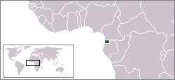
 Equatorial Guinea, Africa Equatorial Guinea, Africa
República de Guinea Ecuatorial
Republic of Equatorial Guinea
Quick Facts About the Country
Capital - Malabo
Government - Republic
Currency - Communaute Financiere Africaine franc (XAF)
Area total: 28,051 km2
water: 0 km2
land: 28,051 km2
Population - 498,144 (July 2002 est.)
Language - Spanish (official), French (official), pidgin English, Fang, Bubi, Ibo
Religion - Nominally Christian and predominantly Roman Catholic, pagan practices
Calling Code +240
Internet TLD .gq
Time Zone UTC+1
Country Background
Equatorial Guinea, officially the Republic of Equatorial Guinea, is a country in West Middle Africa, one of the smallest in continental Africa. It is bordered by Cameroon on the north, Gabon on the south and east, and the Gulf of Guinea on the west, where the islands of São Tomé and Príncipe lie to its southwest. Formerly the Spanish colony of Spanish Guinea, the country's territory (continentally known as Río Muni) includes a number of islands, including the sizable island of Bioko where the capital, Malabo (formerly Santa Isabel), is located. Its post-independence name is suggestive of its location near both the equator and the Gulf of Guinea. It is the only country in Africa where Spanish is an official language, excluding the Spanish exclaves of Ceuta and Melilla and the Sahrawi Arab Democratic Republic.
(Wikimedia Foundation, Inc)
Weather and Climate
The climate is tropical; the average annual temperature in Malabo is about 25°C (about 77°F) and the annual rainfall is more than 2,000 mm (more than 80 in). The wettest season is December through February.
About 63.5 percent (1995) of Equatorial Guineas land area is covered with forest and woodland. Deforestation has occurred, however, as agricultural production has increased. Water from taps cannot be drunk.
(Microsoft® Encarta® Reference Library 2003 and Wikimedia Foundation, Inc)
Major Travel and Tourism Info (Country Travel Guide)
Equatorial Guinea 101 (Basics)
Equatorial Guinea gained independence from Franco's Spain in October 1968. Since then, it has been ruled by two men. Francisco Macías Nguema, the first president, was a brutal dictator who despised intellectuals, killed a large number of the ethnic Bubi minority, banned fishing, and awarded himself a huge number of grandiose titles (including President for Life). He was overthrown by his nephew, Teodoro Obiang Nguema Mbasogo, in 1979 and later captured and executed. Obiang's rule has seen less violence, but his regime is still brutally repressive. Political power is centralized in his small mainland clan, and most senior members of the government are related. The majority of the people are extremely poor. Regions
Río Muni the mainland.
Bioko the largest and most important island. Cities
Malabo the capital, on Bioko
Bata the major city on the mainland
Luba another town on Bioko
Ebebiyin a major access point in the far northeast corner
People
The major ethnic groups are the Fang of the mainland and the Bubi of Bioko Island.
Holidays
Equatorial Guinea recognizes the major Christian holidays. October 12 is Independence Day.
Traveling by plane
There are two paved airports, one a few miles from Malabo (SSG), and one in Bata (BSG). Air service is not extensive and only a few international airlines fly to either airport.
By train
Equatorial Guinea has no railroads.
By car
The major cities are either on islands or on the western coast of the mainland, so it is not convenient to access these areas by car.
Language and Communication
The colonial language is Spanish, and the country is also a member of La Francophonie. There is an Anglophone population in Bioko that is historically linked to British commerce on the island.
Drink
Ebebiyin is known for its large number of bars. They drink a lot of wine.
Staying safe
There are no major conflicts of any threat to tourists and visitors. There is some ethnic tension and resentment against the government. Don't photograph airports, government buildings, or anything of military or strategic value. Don't involve yourself in local politics.
(Wikimedia Foundation, Inc) History in Brief: Summary
The first inhabitants of the region that is now Equatorial Guinea are believed to have been Pygmies, of whom only isolated pockets remain in northern Rio Muni. Bantu migrations between the 17th and 19th centuries brought the coastal tribes and later the Fang. Elements of the latter may have generated the Bubi, who emigrated to Bioko from Cameroon and Rio Muni in several waves and succeeded former neolithic populations. The Igbo people of Nigeria arrived in the 18th century. The Annobon population, native to Angola, was introduced by the Portuguese via São Tomé Island (São Tomé and Príncipe).
The Portuguese explorer, Fernão do Pó, seeking a route to India, is credited with having discovered the island of Bioko in 1472. He called it Formosa ("Beautiful"), but it quickly took on the name of its European discoverer. The islands of Fernando Póo and Annobón were colonized by Portugal in 1474. The Portuguese retained control until 1778, when the island, adjacent islets, and commercial rights to the mainland between the Niger and Ogoue Rivers were ceded to Spain in exchange for territory in the American continent (Treaty of El Pardo, between Queen Maria I of Portugal and King Charles III of Spain). From 1827 to 1843, Britain established a base on the island to combat the slave trade. The mainland portion, Rio Muni, became a protectorate in 1885 and a colony in 1900. Conflicting claims to the mainland were settled in 1900 by the Treaty of Paris, and periodically, the mainland territories were united administratively under Spanish rule. Between 1926 and 1959 they were united as the colony of Spanish Guinea.
Equatorial Guinea became officially independent from Spain on October 12, 1968. Since then, the country has had two leaders: Francisco Macías Nguema, the former mayor of Mongomo under the Spanish colonial government, and his nephew Teodoro Obiang Nguema Mbasogo, who staged a military coup d'état, executed his uncle, and has ruled since 1979.
The 1982 constitution of Equatorial Guinea gives Obiang extensive powers, including naming and dismissing members of the cabinet, making laws by decree, dissolving the Chamber of Representatives, negotiating and ratifying treaties and calling legislative elections. Obiang retains his role as commander in chief of the armed forces and minister of defense, and he maintains close supervision of the military activity. The Prime Minister is appointed by the President and operates under powers designated by the President. The Prime Minister coordinates government activities in areas other than foreign affairs, national defense and security.
On December 15, 2002, Equatorial Guinea's four main opposition parties withdrew from the country's presidential election. Obiang won an election widely considered fraudulent by members of the western press.
According to a March 2004 BBC profile, politics within the country are currently dominated by tensions between Obiang's son Teodorin, and other close relatives with powerful positions in the security forces. The tension may be rooted in power shift arising from the dramatic increase since 1997 in oil production.
A November 2004 report named Mark Thatcher as a financial backer of a March 2004 attempt to topple Obiang organized by Simon Mann. Various accounts also name Britain's MI6, the CIA, and Spain as having been tacit supporters of the coup attempt (see Sunday Herald article).
(Wikimedia Foundation, Inc) References
Bureau of Consular Affairs, U.S. Department of State
Microsoft® Encarta® Reference Library 2003
The World Factbook 2006
Wikimedia Foundation, Inc
| 